Ancient ‘volcano map’ discovered carved into large volcanic rock

An elaborate 2,000-year-old “volcano map” has been discovered carved into a large volcanic rock in Mexico.
Experts from Mexico’s National Institute of Anthropology and History (INAH) recently analyzed the rock, which is on private land in Colima, Mexico. The basalt rock was the result of an eruption from a volcano 8.7 miles away. The eruption, they explained, occurred thousands of years ago.
Standing 5.6 feet at its highest point, the rock is between 7 and 9.1 feet wide and between 2 and 5.6 feet thick, according to INAH.
MYSTERIOUS 18TH-CENTURY SHIPWRECK REVEALS ITS SECRETS
When archaeologists examined the rock, they found maps were carved into it. In a statement, INAH explained that the maps were used to manage the land in that area and also to pass knowledge from one generation to another.
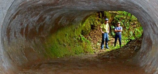
The carved rock is on private land in Colima, Mexico.
The carved rock is on private land in Colima, Mexico. (Photo: Arqlgo. Rafael Platas Ruiz. INAH-COLIMA)
By studying the carving techniques used on the stone, experts say that the work likely took place between 200 B.C. and 200 A.D.
Different engraving techniques were used to represent the volcano’s southern slope, which is furrowed by features such as rivers, runoffs and ravines, according to INAH. On the main surface of the rock, small cavities were carved to represent local communities.


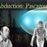
 Creators of mankind
 Description of “Tall white aliens”
 Where they came from?
 About hostile civilizations
 The war for the Earth
 “Tall white aliens” about eternal life
 Video: “Nordic aliens”
 Aliens
 Alien encounters
 The aliens base
 UFO
UFO Technology UFO
 Underground civilization
 Ancient alien artifacts
 Military and UFO
 Mysteries and hypotheses
 Scientific facts